Midwest Hiking Trails That Will Blow Your Mind
Why the Midwest Deserves a Spot on Your Trail List
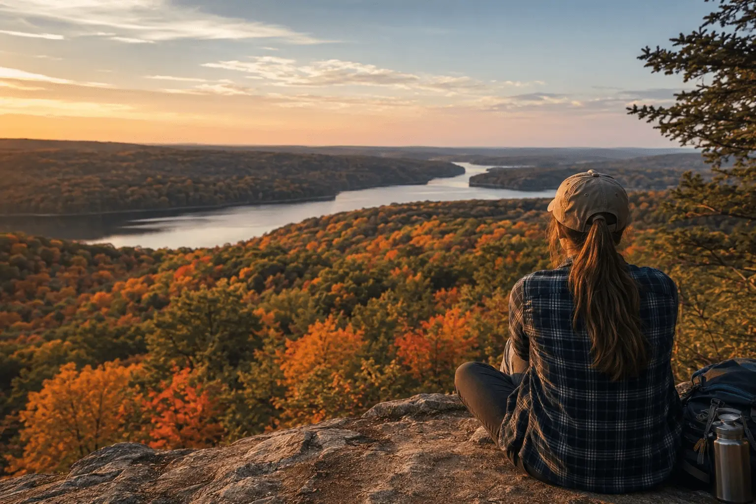
I grew up exploring the Midwest, and I still believe this region doesn’t get enough credit for its hiking opportunities. People assume America’s best trails live out west, but the midwestern states hide a surprisingly diverse palate of landscapes you won’t find anywhere else.
I spent eight years wandering Michigan’s two peninsulas, and that experience shaped how I see hiking altogether. You’ll find Wisconsin, Illinois, Indiana, Iowa, Missouri, and Ohio each offering something different, from quiet rolling hills to dense North Woods.
Ancient glaciers carved this land thousands of years ago, leaving behind rivers, lakes, and freshwater lakes that now border trails winding through deep forests and open prairies. The Great Lakes States and the Great Lakes themselves give this region its geographically diverse landscapes, and honestly, once you start hiking here, you understand why locals call it the Greatest part of the country to explore on foot.
Don’t expect towering peaks or long trails stretching for weeks, though. Ohio, for instance, tops out at Campbell Hill, a modest 1,550-foot summit you can reach by walking up a paved sidewalk.
That’s the charm of it:
These aren’t mountain hikes meant to test your endurance, they’re accessible paths meant to be enjoyed. I’ve kept albums full of photos from my favorite outings, and readers often leave comments sharing their own favorites too. Whether you’re chasing best hikes near home or planning a trip through unfamiliar trails, the Midwest rewards anyone willing to give it a chance.
Quick Answer
The Midwest may not have towering peaks, but it offers some of the most underrated hiking in America, shaped by ancient glaciers into rolling hills, deep forests, freshwater lakes, and dramatic shorelines.
Standouts include Minnesota’s Superior Hiking Trail, a 300-mile route with waterfalls, cliffs, and views of Lake Superior, and Michigan’s Isle Royale, an isolated island paradise for backpackers spotting moose and wolves.
Ohio delivers surprises too, from Hocking Hills’ gorges and recess caves to the sprawling 1,440-mile Buckeye Trail looping the entire state. Illinois’ Starved Rock packs 18 canyons and river overlooks into just 2,600 acres, while Indiana Dunes blends prairie, wetland, and beach habitats along Lake Michigan.
Wisconsin’s Apostle Islands offer sea caves and sunset views, and Minnesota’s Cascade River and Tettegouche State Parks pack multiple waterfalls into short, family-friendly hikes. For long-distance hikers, Michigan’s Pictured Rocks Lakeshore Trail stretches 42 miles past lighthouses and sandy beaches. Whether you want a paved sidewalk stroll to Ohio’s highest point or a multi-day backcountry trek, the Midwest’s diverse trail network has something for every hiker.
Ranked: Midwest Hiking Trails Best to Worst (By a Guide!!)
I’ve spent years chasing hidden gem hiking locations across the Upper Midwest. I had finally hiked enough ground to rank them with confidence.
I explored Northern Michigan, Wisconsin, and Minnesota on foot myself, tackled a few paddling routes along the way, and mapped out thirty distinct hiking trails scattered across this rugged region.
Isle Royale pushed me harder than almost anywhere else, while the Border Route Trail tested my patience in ways few state parks ever have, and I made sure to note the ADA-accessible options for hikers who need them. After walking every one of these paths myself, I ranked them from best to worst, so you can skip the guesswork and head straight to the ones worth your time.
The Top Ten Best Hiking Trails in the Upper Midwest
The Upper Midwest stays underrated whenever people talk about hiking trails, and that’s a shame because the Midwest hides more variety than most hikers expect.
I’ve walked trails that wind past towering sand dunes, tumble beside roaring waterfalls, climb toward incredible overlooks, and duck into hidden sea caves along rocky shorelines.
Living in three different states gave me the chance to explore this region properly, and after years of hiking through it myself, I put together my picks for the top ten best trails the Midwest has to offer.
1-The Superior Hiking Trail
I still think Minnesota holds one of the most underrated gems in the country with The Superior Hiking Trail, stretching an incredible 300-mile long trail through terrain that genuinely surprises people.
I’ve hiked sections where the path climbs through mountains and drops into canyons, offering overlooks of both inland lakes and Lake Superior itself, and honestly the waterfalls you pass rival anything I’ve seen out near the Rockies.
Wooden bridges carry you over streams and rivers along the way, and whether you go start to finish or break it into pieces, the SHT delivers some of the most scenic, best backpacking trails in the entire state.
I’ve stopped to take in countless views more times than I can count, and if a full thru-hike isn’t realistic for you, there are excellent day hiking options built right into the route. Many of the most impressive stretches sit within state parks, but really the entirety of the trail holds potential worth exploring.
2-Hocking Hills State Park, Ohio
Tucked away in southeastern Ohio, Hocking Hills State Park covers over 2,300 acres filled with spectacular gorges, waterfalls, and recess caves carved deep into sandstone. I’ve wandered many of the trails here, which stretch across 26 miles total, giving day hikers the choice between an easy stroll or a genuinely strenuous trip depending on the day.
What struck me most were the deep gorges, unlike anything else in the state, sheltering remnant populations of hemlock and Canada yew that have survived since a cooler time roughly 10,000 years ago.
Camping and cabins sit right inside the park, though I’d steer clear of summer weekend afternoons, since the park stays popular and those high-use times crowd out the natural experience you’re really after.
My personal favorite route starts at Old Man’s Cave, follows the gorge all the way to Cedar Falls, then loops back along the Gorge Overlook Trail for about six miles total. If you want more ground to cover, the park connects directly to the 9,200 acre Hocking State Forest next door. You can reach Hocking Hills State Park easily from either US Route 33 or Ohio Route 56 southeast of Columbus.
3-Starved Rock State Park, Illinois
I never expected to find real Canyons, waterfalls, and tall bluffs in the middle of what everyone calls the flatland of the Midwest, yet that’s exactly what greeted me at Starved Rock State Park, all 2,600-acre of it, in Illinois.
Thirteen miles of trails wind through 18 canyons and lead day hikers like me toward spectacular overlooks of the Illinois River below, a stretch of land the Illinois Department of Natural Resources maintains beautifully, part of the larger 13-Mile Trail Network.
The park’s name carries real weight too. Back in 1769, a group of Ottawa sought revenge for the killing of their chief, Pontiac, and attacked a band of Illiniwek who were camping along the river.
In their attempt to escape, the Illiniwek climbed a high butte above the river, only to find themselves trapped by the Ottawa below. The standoff dragged on until those trapped on the butte starved, which is how the park’s name came to be.
These days, a lodge/restaurant sits on a nearby bluff, so starvation, or even simple hunger, isn’t something you need to worry about anymore. I’d call Starved Rock the most popular state park in Illinois, so plan your visit around the crowds if you can, because the views genuinely make it worthwhile. The park sits west of Chicago, and getting there is simple: take I-80 W to I-39 S at Exit 79A, then follow IL 71 E until you spot the entrance right off the road.
4-The Pierce Stocking Scenic Drive
I count The Pierce Stocking Scenic Drive among the true must-see places in Michigan, and it’s easy to see why once you take the quick cruise through Sleeping Bear Dunes yourself. You’ll roll through a covered bridge and pull up to multiple overlooks stretching across the Dunes, Glen Lake, and Lake Michigan, each one better than the last.
I always bring my camera here since it’s one of the best spots I’ve found for photography, especially during sunset watching, and if you visit in fall you’ll catch some incredible leaf peeping too.
Many of the overlooks are ADA accessible, which honestly bumps this spot up to a solid 10/10 in my book. I’d argue The Pierce Stocking offers some of the best hiking trails for families in Michigan, ranks among the top spots for sunset photography in the state, and delivers the best accessible hiking you’ll find anywhere in Michigan.
5-Indiana Dunes National Lakeshore, Indiana
Tucked into the far northwest corner of Indiana along the shore of Lake Michigan, Indiana Dunes National Lakeshore surprised me the first time I visited, since it’s actually made up of 15 separate parcels of land totaling around 15,000 acres.
I didn’t expect these individual plots to hold such a wide variety of habitats, or such an impressively broad range of day hike options once I started exploring. Honestly, the hardest part of hiking here isn’t the terrain, it’s deciding which of the 14 trail systems, stretching 50 miles in total as part of the 50-Mile Trail Network, to tackle first.
I found the National Park Service signage genuinely helpful in sorting that out. Walking through, I passed hardwood forests, oak savannas, riparian corridors, open prairie, patches of wetland, and of course the signature dunes and beaches the park is named for.
Between the lake and this mix of environments, the park attracts a surprisingly large variety of birds, even sitting inside an otherwise urban/industrial area. Indiana Dunes sits between Gary and Michigan City, IN, with Route 12 running close to most of the parcels.
6-Zaleski State Forest Backpack Trail, Ohio
I always recommend Zaleski State Forest Backpack Trail to anyone in Ohio looking for a weekend campout that’s easy on logistics, or even their first overnight backpacking trip, since the trail sits inside a massive 28,000+ acre stretch of Zaleski State Forest
I’ve configured the loops here into hikes of ten miles, 16 miles, 18 miles, 23 miles, or the full 29 miles, part of what locals call the Ten- to 29-Mile Loops. The terrain stays rolling without ever getting extreme, and you’re almost always tucked inside forest cover.
I’ve found the trail itself well maintained, honestly almost well marked, since I’m still hunting for an old photo I took showing six blazes at a single junction. A few overlooks and small recess caves add just enough variety to keep things interesting along the way. You’ll need a permit to camp, though they’re free and self-issued right at the trailhead.
I’ve stayed at each of the three camp areas, and every one offers several separate tent sites, plus a latrine and a cistern, though keep in mind the drinking water gets trucked in rather than sourced locally.
Zaleski holds a special place for me since it’s where some of my earliest backpacking happened, and it taught me my first lessons the hard way, like realizing you really don’t need six pounds of trail mix for a two-day trip. You’ll find the trail between Chillicothe and Athens, reachable by taking US Route 50 to State Route 278 north.
7-The Entire Island of Isle Royale
Off the coast of Minnesota and Canada sits The Entire Island of Isle Royale, part of Isle Royale National Park, and I still consider it one of the most unique places I’ve ever hiked. The island stays isolated from the mainland, which creates a closed ecosystem and honestly feels like stepping into a whole other world the moment you arrive.
You’ll find endless options for backpacking loops here, winding past rugged cliffs and along well-maintained trails, with abundant wildlife that includes moose and wolves roaming freely. I’d call Isle Royale home to the best backpacking in Michigan, and honestly some of the best backpacking anywhere in the Midwest, rivaled only by Minnesota’s Superior Hiking Trail.
I genuinely think Isle Royale is a hiker’s paradise, and I’d tell anyone to book a trip out there without hesitation.
That said, Isle Royale can be incredibly difficult to reach, since you’ll need either a ferry or a seaplane ticket to get there, which is exactly why I’m docking one point from the island’s overall score for its lack of accessibility.
Accessibility aside, Isle Royale offers some of the best hiking in the Midwest, along with incredible kayaking and canoeing. 9/10.
8-The Chapel-Basin Loop of the Pictured Rocks
I’d rank The Chapel-Basin Loop among my favorite hikes in Pictured Rocks, an 11-13 mile hike that takes you past two and a half waterfalls and delivers some genuinely incredible views of Lake Superior along the way.
I’d call it one of the best hiking loops in the Midwest, honestly maybe the world. The bugs can get rough out there, and this trail turns crowded during peak summer weekends, but I still give it a solid 10/10 and recommend it for anyone’s bucket list.
I stopped at one overlook and snapped an old-style iPhone shot, the kind you’d get playing around with photo editing afterward. As part of the Pictured Rocks National Lakeshore, this loop offers several overnight camping options scattered along the route.
You can even backpack the whole stretch from Grand Marais, Michigan, to Munising, Michigan, tracing the Pictured Rocks Cliffs the entire way. It’s a longer backpacking route, running about 3-4 days, but I’d still call it one of the most beautiful backpacking routes in Michigan, and one of the best backpacking routes in the Midwest.
Overall, The Chapel-Basin Loop stands out as one of the best trails for photography and views anywhere in the Midwest. 9/10.
9-Cascade River State Park
Just south of Grand Marais, Minnesota, I found Cascade River State Park to be one of those rare few places where you can hike less than one mile and still spot as many as seven waterfalls along the way.
The park tends to get crowded during summer, so I’d time your visit around when the falls are best viewed, either in spring when they’re full from snowmelt, or right after the rain. I’d call this a great waterfall hike for families, photographers, or really anyone with limited time hoping to catch some of the best waterfalls in Minnesota.
From here, you can hop onto the Superior Hiking Trail right from the Cascade River and head up into the Sawtooth Mountains, or follow the river further for more views and a string of smaller falls. Overall, I’d rank Cascade River State Park among the best easy hiking trails in Minnesota. 9/10.
10-The Apostle Islands Lakeshore Trail
Above the famous Apostle Islands Sea Caves, I found one of the best hiking trails in the Midwest. The Apostle Islands Lakeshore Trail offers sweeping views down into the sea caves, delivers incredible sunsets over Lake Superior, and lets you spot the North Shore off in the distance, all while walking past beautiful spring wildflowers.
I’ll admit the trail gets crowded on summer weekends, but I’d still rank it among the best hikes in Wisconsin for families wanting a moderate challenge. You can even turn it into a backpacking trip by backpacking 5 miles to the only mainland campsite inside the Apostle Islands National Lakeshore. Just keep in mind Permits are required to camp in the National Park. 8/10.
11-The Buckeye Trail, Ohio
I’d call The Buckeye Trail an interesting animal among Ohio’s hiking routes, stretching 1,440 Miles, or 1,444 miles by some counts, across the entire state. Despite long portions being road walks or paved trails, I’ve still found plenty of nature worth seeing along the way.
I put this on my list of best hikes in the Midwest purely because of its sheer length while staying within one state, winding through a big loop that also branches into smaller loops and spurs.
In more than one spot, the trail shares tread with most of the other trails I’ve hiked across the state. If you’re chasing a thru-hike that few others have finished, this might be the one for you, though be warned it also comes with hundreds of miles of road walking and long stretches with no camping options.
Thankfully, there are plenty of solid choices for section hikes instead. The pathway cuts through Ohio’s only national forest, passes Cuyahoga Valley National Park, and touches 18 state parks, five state forests, four wildlife areas, eight Ohio Historical Society properties, six Watershed Conservancy lands, and 18 county or Metropark lands. Whatever length and challenge level you’re hoping to find in a hike, chances are the Buckeye Trail has it somewhere along the way.
12-The Superior Trail, Minnesota
I’ve hiked long stretches of The Superior Trail myself, and it genuinely runs 255 Miles, generally tracing a ridge above the north shore of Lake Superior, according to the Superior Hiking Trail Association.
This linear route travels nearly to the Canadian border starting from Duluth, and the trail actually keeps going another 41 additional miles south through the city toward the Wisconsin border, though since backcountry camping isn’t allowed through that stretch, I wouldn’t call it part of a traditional thru-hike.
The main highlight, at least for me, has always been the nearby presence of the big lake, the Ojibwa people, and later Gordon Lightfoot, called Gitchi Gami, meaning Big Water. You’ll catch stunning views of the water constantly, and streams and rivers flow into the lake while the path often lines up perfectly to reveal a spectacular waterfall where the flow drops off the ridge toward the lake below.
The trail itself doesn’t throw huge climbs at you. The lake sits around 600 feet above sea level, and the high point along the trail climbs a bit over 1,200 feet higher than that. I’d still call the trail moderate to challenging overall, since hiking rarely stays on flat ground, with steep elevation changes cutting between river valleys and ridgetop sections.
There are no permits or fees required to hike, but campers must stay at one of 93 established backcountry campsites, each offering multiple tent pads, a fire ring, and a latrine, with a water source typically nearby.
13-Lakeshore Trail, Pictured Rocks National Lakeshore, Michigan
I’ve walked long stretches of the Lakeshore Trail myself, and it genuinely stretches 42 Miles along the south shore of Lake Superior, according to the National Park Service. The trail features incredible overlooks, sandy beaches, waterfalls, lighthouses, and plenty of camping spots along the way.
That same distance overlaps with the North Country Trail too, which keeps going further in each direction, totaling roughly 4,600 miles overall. I’d describe the hiking here as moderate, with a handful of climbs between bluffs overlooking the lake down to stretches that hug the water itself.
There are 11 backcountry campgrounds you can reserve through recreation.gov, and most camp areas come equipped with community fire rings and bear-proof lockers, plus water sourced from either streams or that big nearby lake, so I’d recommend packing a water filter just in case.
If you’d rather not backtrack, shuttle services are available for hikers covering the entire distance one way. Pictured Rocks National Lakeshore sits along the south shore of Lake Superior in Michigan’s Upper Peninsula, stretching between the communities of Munising to the west and Grand Marais to the east. Alger County Road H-58 provides access throughout the Lakeshore Trail.